First-hand accounts of what we've been up to on the VWS Endurance Challenge |
||||||||||||||||||||||||||||||
The VWS Endurance Challenge
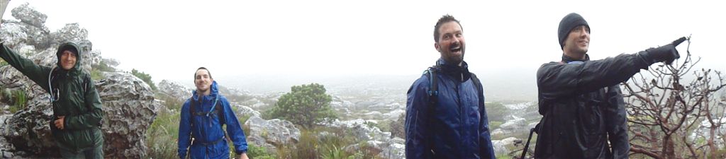
(by Ryan Heydenrych & Edited by Peter Wynne) Six hikers representing the whole of the Volunteer Wildfire Services successfully completed the VWS Endurance Challenge, a 180km hike from Cape Point to Signal Hill, 30 September – 03 October 2010. In the early hours of Thursday morning Kate Snoodyk, Peter Wynne, Ryan Heydenrych, Ruedi Siegenthaler, sTiv Samuel and Tarren Smith, the 6 volunteer fire fighters taking on the challenge, were picked up by their logistics team and taken to Cape Point to begin this epic adventure. Shortly after 8am the team walked to the upper lighthouse at Cape Point. Anyone who has visited this spot will know that the view is amazing. The view that day held a daunting challenge to the team. There was a nervous energy amongst the group as there was such a long road ahead. Day
1 - Cape Point to Capri After lunch the team headed up a steep ridge and along towards Swartkop. By the time evening was setting in the team were just over half way. A hot dinner and refreshments were supplied to the team, at the TMNP Law Enforcements quarters, by the positive and very supportive VWS members who formed the logistics team, lead by Bronwyn Thompson. The team prepared for the evening with warm
gear and headlamps and headed off into the setting sun knowing that the work
for the day was only half complete. The Red Hill section of day tested the team
to the maximum. The paths are very sandy and on tired legs sand is your worst enemy
requiring maximum effort to keep moving. In the dead of night with a marathon
distance of mountainous terrain behind you the last thing you want is sandy
shoes and difficult conditions but never the less the team struggled through it
and finished the day with 56.5km covered. One to highlight the beautiful TMNP that is
on our doorstep and that we as fire fighters strive to protect from devastating
wildfires. Please
Sponsor Our Efforts: Sponsor Us Any
donation makes a huge difference in enabling the Volunteer Wildfire Services to
combat wildfires. Please consider supporting this amazing organisation and the selfless
volunteers who give so much to protect the flora and fauna of our mountains. | 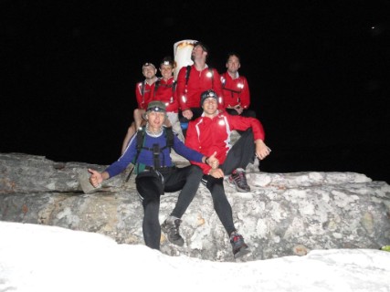 -  -  -  -  - 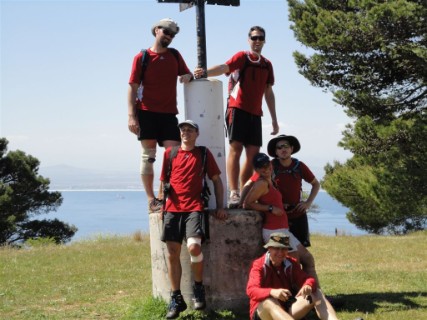 - 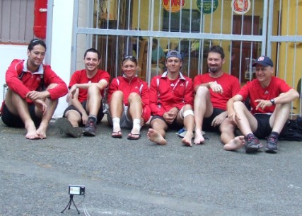 |
===========================================================================================================================================================
Training Hike 14: Rooikrans - Sunday 19th September 2010(by kate Snoodyk) I have to ask, what is it with all the beach sand on this peninsula – I mean really, as if hiking up and down mountain wasn’t tiring enough, now we have to deal with aching calves from the soft sand as well! The things one has to deal with in order to raise awareness and generate some much needed funding for this great organization…. Given that we will be walking in two weeks we decided to do a short recce around Glen Cairn and the top end of Capri area. We needed to see if there was a path down to our first nights accommodation from Rooikrans. Sadly there isn’t one but we did come up with plan B and felt safe with the knowledge that we now know what we don’t know – true hikers reason! We only walked for about 3 and a bit hours but it was rather pleasant as we missed the rain – yes, you heard correctly, we actually missed the rain! I know that this has come up often but really, we live in such an incredible place and the mountain has offered us such an incredible array of fauna and flora. Including those plastic looking red locusts and furry bees and no, we’re not beginning to hallucinate from all the fresh air, they really do exist. Oh and word of advice to all those caterpillar lovers out there – keep your furry beasts away from Ruedi as he has taken a liking to them… So are we ready? Can one ever be ready when setting off on an adventure like this? I think that we are, in as far as we can be. No matter what happens, the lead up to it has been a veritable display of colour and beauty and despite the early mornings and some terrible weather, it has been an enjoyable experience. We can all only hope that next weekend goes as well. In any event you will be able to read all about it right here….as with the overused phrase – Watch this Space! Stats: Distance covered: 15.5 km Time: 3 hrs 28 mins Altitude gained: 410 metres 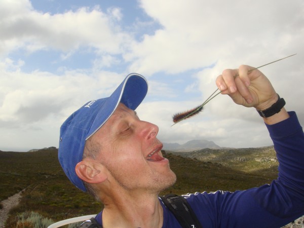 | 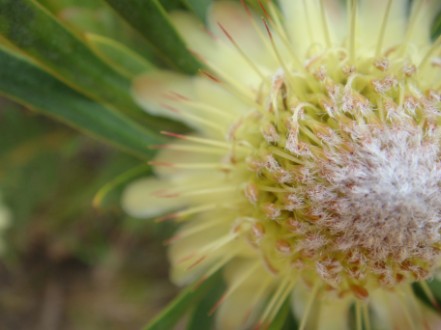 Above - One of the many beautiful flowers we continue to encounter in the Table Mountain National Park Below - The path we walked on the day, with a bit of a recce section to determine the route to our first overnight break area  - Map.jpg.opt441x286o0,0s441x286.jpg) Below - Despite the high looking peak in altitude profile, this section of the walk is the flattest area will will walk through for the Challenge Left - Ruedi demonstrates that he is happy to eat any thing if we happen to get lost on the walk  - Altitude Profile.png) |
==========================================================================================================================================================
Training Hike 13: Hout Bay Leg - Saturday 4th September 2010(by Ryan Heydenrych) There are only a few routes that we have left to scout out. On Saturday 4th September Ruedi, Kate, Peter, Tarryn and I, (Ryan), set off from Suikerbossie. (sTiv was celebrating his Birthday on Saturday with a hike of a different kind. We are sorry we missed out sTiv and hope you had a great day). The first peak of the day was to be Little Lions Head. The climb is steep but short and the wind was more of a challenge than the slope. As we ascended the wind whipped across us from the North West and could easily throw you off balance if you were not careful. I was looking forward to the view from the top as I thought about the route earlier in the week but we were out of luck… the summit was completely covered in cloud. The way down Little Lions Head is the same way as you go up so we trundled along and then descended down towards the path that takes you to Sandy Bay. This section took longer than expected. Our legs were a tad scratched up from a few bushes on Lions Head and our shoes full of sand so we paused for a moment to clean our shoes before walking along the ocean and then upward to the dunes of upper Hout Bay. The walk up was quite a slog but the warmer weather was welcomed. Our next target was Suther Peak. As with Little Lions Head we were challenged by the wind and the mist as we climbed. The climb is very steep, you feel your legs screaming at you very early on and they don’t stop… There are some sections where a bit of scrambling needs to be done but there are ropes to assist you. Over the past couple of weeks the group has commented on the fynbos that has really started to explode with colour and flowers. Hiking as often as we have been has meant that we have seen the onset of Spring and it has been a great reward to experience. In sections of the hike up Suther Peak it was like walking through a perfectly landscaped garden… and even in the dull light of the mist the colour was amazing… Peter particularly enjoyed the flowers… Suther Peak really is a great section. As you approach and round the peak you enter into a rocky section with great overhangs and little caves. A little further along you walk through an indigenous Yellowwood forest. Crossing the saddle and heading towards the radar station was probably the coldest section and all the warm gear was brought out. It was interesting to walk through the burnt area that VWS crews were called out to earlier in the year. The Karbonkelberg call out saw numerous crews responding to this area of the mountain. When you walk through pristine fynbos and hit a section that has been burnt you can really see the long term impact fires have on the vegetation. Every section of vegetation that the VWS manage to save in fires is so valuable. The last section of the walk we covered a good distance in a short amount of time. We descended Karbonkelberg into Hout Bay popping out on the road by the harbour. The route from there was all on the road but it’s the exact route the VWS Endurance Challenge will follow so it was good practice. All in all it was a great hike, not too far but the height we gained added the required fitness training. There is only one part I left out… we received our adidas sponsored kit adidas have very kindly got behind the VWS Endurance Challenge team taking on the hike. They have sponsored gear including shoes, shirts, pants and wind breakers. All of this is top notch quality and much appreciated by everyone. We now look the part and are one step closer to being ready to take on the 180km… if you can ever be ready… wow it’s going to be a long way. Stats: Distance covered: 17.9 km Time: 5 hrs 30 mins Altitude gained: 1210 metres |  - Picture.jpg.opt427x320o0,0s427x320.jpg) Above - Removal of sand and twigs from our shoes was needed after descending Little Lion's Head Below - The out leg involved climbing Little Lion's Head, Suther Peak and Karbonkelberg, the return leg was up the road  - Map.jpg.opt427x277o0,0s427x277.jpg)  - Altitude Map.png) Above - The steepness of the climb up Suther Peak can be clearly seen in the altitude profile Below - Just one of the many photos taken of the flowers that Peter really enjoy, but that we were all astounded by the beauty of the fynbos 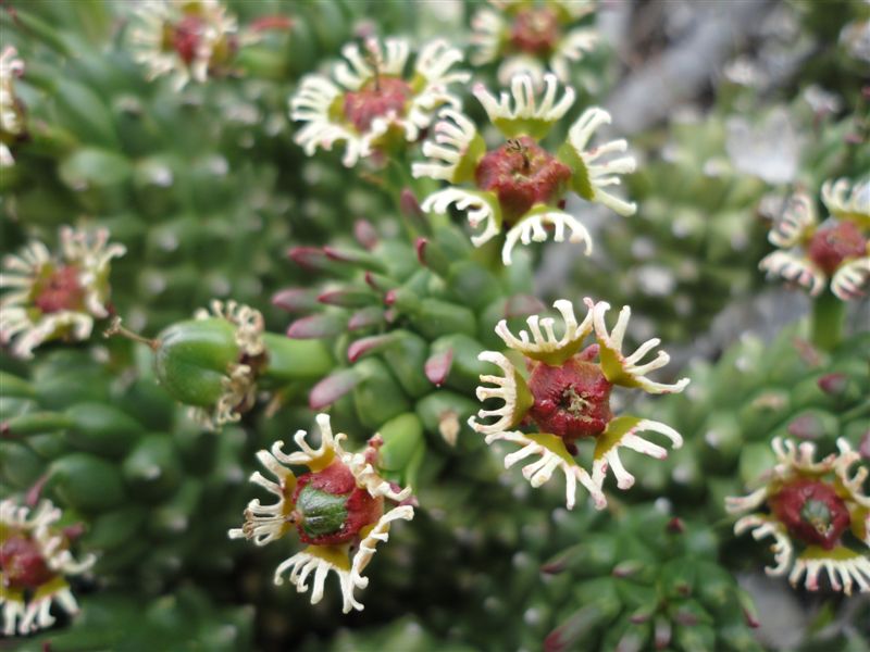 |
==========================================================================================================================================================
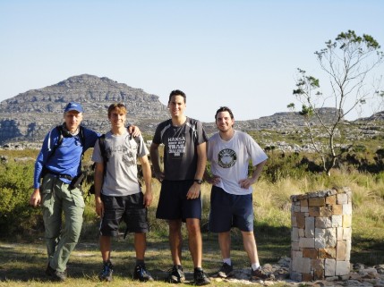
Training Hike 12: Pine Haven/Kleinplaas Dam Area - Saturday, 28 August 2010(by Peter Wynne)
After already cancelling two recce hikes in the Simon's Town to Fishhoek area due to bad weather we decided that it had to be done and that last Saturday was the day (if only we had known that Sunday would have turned out to be such a stunning day...). Granted many of us had other VWS Training Sessions to attend to prepare for the coming fire season. When this idea was first hatched we knew we would be training in winter but as we aim to create awareness before the fire season that could not be avoided... if only we had know we would have to hike in the conditions we did I am sure all of us would have said no from the start. Anyway, we did have the ‘opportunity’ to do some hiking in truly bad conditions. Just after we started the rain began driving down and, on the few occasions, just when it looked like an inkling of light through the clouds the wind blew to remind us that is was just that cold. No matter how well dressed we were we ended up soaked through... we all tested our rain gear beyond the limits that it was designed for. But, although cold, we walked on the path past Grootkop after leaving the Naval Station on Red Hill, our starting point. Our aim was to travel the old jeep track that runs above Scarborough and Misty Cliffs but with conditions deteriorating and having found the path to be clear we retraced our steps back the Grootkop, which we promptly climbed. There were some nice crevices to climb up and on a clear day the view could be rather good. Tarren thought he would climb up the very top and have a look… with the wind as it was we are lucky that he wasn’t made airborne and lost to us all… We choose to cut the hike short as we strolled passed Kleinplaas Dam and headed back the Pine Haven road, and although we planned to end in Fishhoek, we returned to the starting point. As the road was an easy walk Peter picked up the pace to try keep warm and Ryan entertained us all by acting like a hyperactive kid running through all the puddles. He did keep the spirits up, granted it seemed sTiv was a pretty happy chappy in the rain and on a level road.
With very few peaks in the area that have official paths up to the top of them, the walk is relatively flat in the area which is a nice change from the huge climbs that we will face later when we attempt the full hike and a chance to keep energy levels up and eat up the kilometres as we walk. Once we got back the start, completely soaked, we piled into Tarren’s car, a Jeep… a proper grown up car compared to what the rest of us have. The heater was hurriedly turned on and we drove back the Fishhoek for some of sTiv’s brownies = yummy! I am sure warm showers were enjoyed by all once they got home… I look forward to a dry hike for the next one. PS: Tarren, we're sorry about the car seats... well, we might be at least. Stats: Distance covered: 15.2 km Time: 3 hrs 00 mins Altitude gained: 455 metres |  - Picture 1.jpg.opt261x395o0,0s261x395.jpg) Above - Tarren narrowly beat sTiv to the top of the only peak we completed on the hike, Gootkop  - Map.jpg.opt429x279o0,0s429x279.jpg) Above - The route hiked starting at the Signal School around the Pine Haven/Kleinplaas Dam area Below - The altitude profile of the hike, all rather flat besides Grootkop, the only major peak climbed  - Altitude Map.png) |
==========================================================================================================================================================
Training Hike 11: Skeleton Gorge - Thursday, 26 August 2010(by Tarren Smith)There is a strange relation between human beings and the way we use energy. We use energy to manufacture batteries, then we use more energy moving said batteries around to shops then even more going to buy them only to make them last as long as possible. Entropy, I think to myself, as I imagine the world deteriorating into a more chaotic place due to my headlight throwing just enough light to see a footing place in the dark and watching my exhaled lung fulls of air condensate in the cold. Apparent by the solid cone of reflected light emanating from my forehead and ending on the path in front, we had reached the cloud. We were speaking about the origin of the name “Skeleton George” as we passed the cave where the skeletons of prisoners were found many years ago. The darkness stiffens the senses and one begins to imagine ghost like sounds, flashes of light and… skeletons. We had advanced from Newlands, once again, and ascended Skeleton George. It was a rainy and windy evening as we, in our projected light envelopes, traversed the east side of the mountain. We descended via the cement track, somewhere in Europe, Cecelia Waterfall and the top boundary of Kirstenbosch Gardens back to Newlands. So, I think to myself while trudging in the dark, would the world have been a less chaotic place had Ruedi carried us all on this walk? I think not, not that is, if he didn’t hold his breath the whole way and ever buy batteries. Interesting: If you have lost a plastic bag with a piece of foam in it - Ruedi has it. Watch the shop shelves for a water catchment device to be used to capture the condensate coming out of noses while hiking in the cold. Still haven’t figured out the tinfoil things. There may be ghosts on table mountain after all. If you have a spare aeroplane (Boeing 737 size at least) please give it to sTiv. Stats: Distance covered: 15.7 km Time: 3 hrs 50 mins Altitude gained: 1170 metres |  - Picture.jpg.opt407x305o0,0s407x305.jpg) Above- As Ruedi leads the group he turn to take a photo just catching Tarren being followed up by sTiv and Peter  - Map.jpg.opt429x279o0,0s429x279.jpg) Above - The hiked route from Newlands VWS Base up Skeleton Gorge and back via Kirstenbosh |
==========================================================================================================================================================
Training Hike 10: India Venster - Saturday, 14 August 2010(by Ruedi Siegenthaler)
What a gorgeous day we seem to have chosen for that walk. We were greeted by a stunning sunrise in the morning and for the first time we are all together for the day's hike. Tarren just got back from a working trip to Germany and sTiv joined us again after a break due to flu. So, we met at 7h00 at the base in Newlands Forest and started hiking at a gentle pace up to the blockhouse and along the contour where we stopped for a moment to admire for the last time the Athlone cooling towers as they were coming down the following weekend. As old habits seldom die, the sampling of stream water had to be carried out along the few streams and, for some reason only known to the insiders, they started being compared with beer from Zim......?! For most of the way along the contour path we were all chatting away happily until we started going up on the path towards India venster. Suddenly a big silence kicked in as everyone had other things on their minds or was it just the lack of oxygen in the system on the way up....
We could not let that happen and so we pushed on again along Fountain ledge with its breath taking views over Camps Bay and the twelve Apostles towards the top. From there we walk for about 500m on the cement path towards MacLear’s Beacon until we got to the path, which lead us down into Echo Valley. Having had some fun along the boardwalk up the Valley, we hiked until we got to the intersection with the Smut’s track. From there it went all down hill by the means of Skeleton Gorge and so we found, that the little tinfoil “research” things in Skeleton Gorge along the path is still going on (anybody got any idea what they are researching let us know at endurancechallenge@capefires.com). Passing the ladders, Peter started getting a little slower as his knee’s started giving him a little bit of an uphill! Just before joining the contour path, we bumped into Gavin Bell, Park manager of the South and Central, who was on his way up. After we have had a little bit of a chat with him, we went on through the upper part of Kirstenbosch into Newlands Forest back home to the base. We all had a great time out there and who would have guessed, that some of us would meet each other less than two hours later again, but this time on the fire line! Read the article about the fire on the VWS website – Click here.
Stats: Distance covered: 20.6 km Time: 5 hrs 45 mins Altitude gained: 1260 metres |  - Picture.jpg.opt421x315o0,0s421x315.jpg) Above - Ryan, Tarren, Ruedi, Peter and sTiv all getting a little twisted in the pose... Below - We hiked from Newlands round the front of Table Mountain, up India Venster and back via Kirstenbosch  - Map.jpg.opt417x271o0,0s417x271.jpg)  - Altitude Map.png) Above - The route's altitude profile Below - A queue formed on the climb up India Venster  - Picture 2.jpg.opt379x284o0,0s379x284.jpg) |
==========================================================================================================================================================
Training Hike 9: Simons Town - Sunday, 1 August 2010(by Ryan Heydenrych)
Around the hour of 07h00 on Sunday morning sTiv, Ryan, Ruedi, Peter and Kate met in Simons Town. We left our vehicles there and, with Ruedi as the taxi driver, we drove down to Cape Point gate where the hike was to begin. The plan for the day was to hike from Cape Point (entrance), cross over a few peaks and end up in Simons Town and that’s exactly what we did.
Stats: Distance covered: 18.1 km Time: 6 hrs 04 mins Altitude gained: 1160 metres | 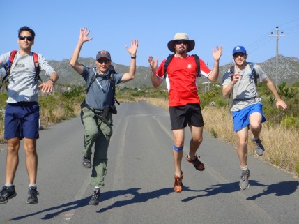 Above - When the world dropped away from under the hikers it seems Ryan (far left) was the only one to maintain his composure (at least Ruedi, sTiv and Peter managed to keep their hats on) Below - The altitude profile of the route hiked from Cape Point gate to Simons Town  - Altitude Profile.png) 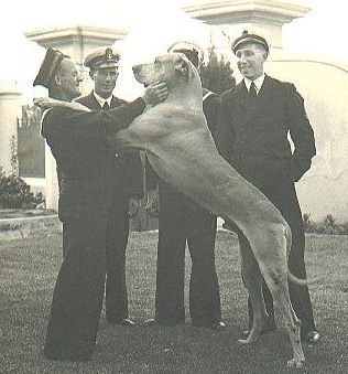 Above - Just Nuisance at the Union Jack Club in Cape Town |
==========================================================================================================================================================
Training Hike 8: Devil's Peak - Monday, 26 July 2010
(by Peter Wynne)
As a change from the normal full moon hike, we decided to ditch the rather boring and far too packed hike up Lion’s Head to undertake a rather more challenging hike, Devil’s Peak. Kate, sTiv, Ryan and Peter set out into a rather cold evening from base.
A quick trek up to Newlands Ravine from the Newlands Station via the contour path soon had us warmed up enough to start taking off excess layers and wondering if it really was actually all that cold. Anyway, upward we went and on the way up Newlands Ravine, Kate once again took off like she had stolen something and the rest of us were attempting to catch her. We eventually did so at the saddle and had a bit a tea provided by the ever resourceful sTiv. However, that was not the final destination and again we took off to the peak. Upon arrival we were afforded some incredible views of the moon and down over the city lights with the occasional wisps of cloud blowing through the saddle below us. Again, sTiv dug into his bag and came out with some port this time, which was rather appreciated. However, he also failed to have charged batteries in his camera… On the descent to the saddle, Peter couldn’t seem to stay on his feet (which everyone else promptly blamed on his one sips of port), and after further thought, rolling down the mountain might have been easier. Near the end of the climb down just above the contour path and before sTiv decided to do his wooh-ga wooh-ga dance (imagine a headless chicken running about) around the octagonal bench set up, Ryan’s legs started to take a little strain (granted he had just run the Hout Bay Challenge the previous Saturday so he was promptly forgiven and Peter’s knees were secretly grateful for the slower pace). We ambled back into base, glad for having done the hike, at 11pm and everyone desiring their beds. So in summary: We went up, we went ooh, we came down, fun was had by all… the end. Final advice: go up Devil’s Peak, not Lion’s Head, for a proper full moon hike.
Stats:
Distance covered: 11.3 km
Time: 3 hrs 57 mins
Altitiude gained: 1169 metres
===========================================================================================================================================================
Training Hike 7: Kalk Bay - Sunday, 25 July 2010(by sTiv Samual) "It all looked flat on the map" - Anonymous Hiker (also, for some random reason, attributed to Peter) For the next in our series of
trans-Peninsula stroll training hikes, we decided to tackle the meander from
Kalk Bay to Chapman’s Peak, with a smattering of peaks thrown in between the
two. Kate, Ruedi, Peter and sTiv met at Silvermine as the sun was rising and the almost-full moon setting, and did a ‘car shuffle’ by leaving the majority of the fleet in upper Noordhoek under the watchful eye of old age home security (to keep baddies out, not the old in!). We all bundled into one vehicle to drive down to our starting point. Vehicular support will be just one of the very necessary functions of our support team on the actual event – for the transportation of everything from spare pairs of socks, to foodstuffs, to cheerful dispositions. We set off from sea level in Kalk Bay, up to Weary Willy’s and the Amphitheatre, relishing the “creamy glow” (descriptive definition no.1) of early morning sunshine as we ascended. Over the course of the day, various members of our party were admonished to come up with ever-more descriptive ways of defining the nice stuff they saw… “stunning” would just not cut it. The fact that “stunningly stunning” popped up with regularity after that can only be ascribed to the sarcastic nature of team. A later attempt to describe the waters of Hout Bay as “stunningly sparklingly stunning” was just pushing it too far. We meandered off course a few times on the plateau above Boyes Drive, blaming the publication date of our map a few times. Kate was having issues with her GPSs batteries, so we couldn’t rely on technology to guide us. So many of the paths on the mountain have been rehabilitated / repositioned / refynbossed that we were often at a loss as to where exactly we were. Higher ground on the top flanks of Muizenberg Peak (virgin ascents for both Ruedi and sTiv, despite their decades of mountain hiking experience) afforded better views of paths threading through the knee-high fynbos. We aim to walk more direct routes on this section when we next attempt the traverse. We passed our fair share of Sunday hikers – everything from a mom with throngs of kids (as if all the other parents had dumped her with parent duties while they slept in), to pairs of older ladies walking amidst wafts of too much perfume, to small groups of hikers with every size of dog in their party (some responsibly on leads, others ranging v e r y far and wide, as if to test their – hopefully – ‘WildCard’ed freedom). Occasionally, whilst poring over our map to figure out the optimal route for our day’s stroll, fellow hikers would stop to offer assistance, perhaps duped by Ruedi’s Swiss accent. The looks on Silvermine hikers’ faces when they realised that we’d walked from Kalk Bay and were figuring out the best way to get up and down Chapman’s Peak were… well: “stunning!” And it was indeed a good push. Based on what we learned on this training hike, we’ll re-route our trek to minimise unnecessary ascent, aiming to head up Chappies from Noordhoek Corner instead. Coming down that way in the mid-afternoon sunshine, we must’ve been lacking in essential salts or necessary sugars, because we entertained ourselves with such nonsense as brainstorming an alternative phonetic alphabet, and then testing each other with random words: “Hindu Onomatopeoia Underpants Testosterone [break] Bikini Alfalfa Yodle” being one such example. Once again, an excellent time was had by
all – particularly those with obscure and liberal imaginations! If only all hiking groups could be such fun. Words we’re aiming to improve on in future: “stunning“. Words Kate still hates: “chillax”. Stuff sTiv doesn’t like: uphill. Stuff Peter should remember: suncream. Ruedi’s pace: as quick as ever! Stats: Distance covered: 28.4 km Time: 8 hrs 14 mins Altitiude gained: ~ 1775 metres |  - Picture.jpg.opt429x321o0,0s429x321.jpg) Above - sTiv and Peter are entertained by Ruedi's impromptu 'sock puppet' show Below - The hiked route from Kalk Bay to Chapman's Peak and back to Noordhoek Village .jpg.opt429x284o0,0s429x284.jpg) |
===========================================================================================================================================================
Training Hike 6: Constantia Nek - Sunday, 17 July 2010(by Kate Snoodyk) Water – H2O – defined in the Oxford English Dictionary as “a colourless, transparent, odourless, liquid which forms the seas, lakes, rivers, and rain and is the basis of the fluids of living organisms” …. Given this it is amazing that we were able to generate enough conversation on this very topic to last a 7 hour hike! Apparently much joy is to be had from sampling water pouring off the side of the Silvermine mountain and subsequently describing its qualities using are array of adjectives that would leave the unaware passerby assuming that gallons of liters of wine had been sampled on route….. This was our hike from Constantia Nek through the Vlakkenberg up Blackburn Ravine to the summit of Noordhoek Peak, down again and up to the top of Constantia Berg and then all the way back again. To say that that the scenery is breathtaking would be an understatement …. The black tipped proteas along that densely cover the mountainside are enough to cause many three second photo stops. The mountain is in full bloom making these hiking trips all the more enjoyable and then of course there is more water to be sampled and described in minute detail! The hours spent on ones feet seem to pass in the blink of an eye whilst one is completely distracted by natures overwhelming beauty. Vocab Update: Wobbleage - not a good thing! Stats: Distance covered: 25.7 km Time: 6 hrs 43 mins Altitiude gained: 1518 metres |  - Picture.jpg.opt429x322o0,0s429x322.jpg) Above- Ruedi and Peter plot the route while a rather confused Ryan looks on Below - The hike took us from Constantia Nek to Noordhoek Peak and back again  - Map.jpg.opt429x283o0,0s429x283.jpg) |
===========================================================================================================================================================
Training Hike 5: Cape Point - Saturday, 3 July 2010(by Kate Snoodyk) There were sounds of grumblings rumbling through the suburbs of Cape Town as 6 valiant souls (5 hikers and one poor driver) dragged their objecting bodies out of bed to make their way to Cape Point Reserve section of Table Mountain National Park for the 5th training hike. Upon arrival at the main gate we all piled into Bronwyn's little car (which may or may not still have it's under carriage intact) and made our way out to the point. From there the 5 of us set out at a pace (there were soccer matches not to be missed later on in the day - Go Germany!) for our first summit of the day (Vasco da Gama). There were obligatory ooohs and aaaahs and wonderment at the loos with the amazing view. Our leaders then decided in all their wisdom that the best plan of attack was to descend to sea level to gather some fine sand in our walking shoes before attacking our next summit (Paulsberg). After some serious food talk we reached the top for more ooohs and aaahs and a bergie impression from sTiv. Over the saddle we went, interjecting the silence with our scintillating conversation and up to the top of Judas (the first) Peak. Unfortunately Tarren and Ruedi had to make tracks once we joined the main road as the soccer beckoned. sTiv, Peter and Kate decided to do this walk the justice it deserved and trundled up to the top of Rooihoogte, the last planned peak located inside the park. Lessons learnt from this hike - the gloves are off with regards to the production of drool worthy sandwiches. Vocab Update: Chillax Stats: Distance covered: 19 km Time: 5 hrs Altitiude gained: 1031 metres | 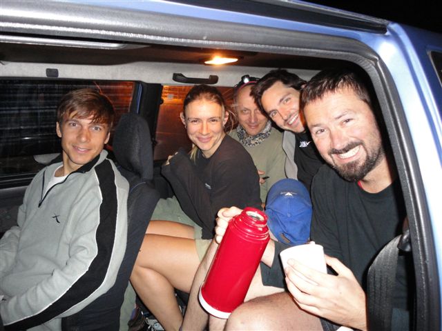 Above - Front Left to Right: Tarren, Kate, Ruedi, Peter & sTiv all squeezed into Bronwyn's poor Uno Below - The route hiked, up the False Bay coast line .jpg) |
===========================================================================================================================================================
Training Hike 4: Table Mountain - Saturday, 27 June 2010(by Tarren Smith) There is something about waking up before it’s light on a Saturday for working folk. It seems like the body rebels and hangs onto what rest it possibly can. Therefore even after arriving at Newlands base everyone still looks half asleep and rather groggy. Never the less, five of us set off on this morning as eager as ever for 5 hours of walking…...that’s a really loose 5 hours, more like 7 actually. A couple of stiff little hills on the way from Newlands base via Kirstenbosch Gardens to Constantia Neck got the blood flowing. We even managed to squeeze in a pre-victory lap around the irrigation dam and a little backtrack to the contour path just because Ruedi said. We reached the cement track leading to the dams from Constantia Neck in record time and began the incline to Eagles Nest. At this point we diverted from the road most travelled (or so we thought) and ascended in a northerly direction following the ridge. We were treated to untainted views from Muizenberg to Houtbay. It wasn’t long before we could see De Villiers dam far below us. Before we began the decent we needed to get to one of the selected peaks to be concurred during the challenge. We found a feint path leading North-West and followed it along a rocky ledge only to be faced with an impassable crevasse. Luckily an old Yellowwood tree has made the crevasse its home and forms a convenient branchy bridge on which one can cross. The peak, Klassenkop, is a real treat. The top is small and rocky with a vertical drop on the west side, the giant rock crack on the east and views north and south of the Back Table and Hout Bay respectively. The stop wasn’t long as mileage needed to be covered. We descended to De Villiers dam and met up with the cement road. We said goodbye to sTiv (as he returned to Constantia Neck) and carried on toward the Woodhead Wall. From there we followed the old railway line to the junction where we turned toward Groot Kop. It was uncharted terrain for all of us so Murphy took the lead and yes, on the wrong route. We decided to push on as we had gone so far and ended up rock hopping to the peak where we met a group of about 15 people eating lunch. They gracefully pointed out the path down. Our target reached, we backtracked to Woodhead dam and headed down Skeleton George and back to base at Newlands. After all this I have one question: Did Ruedi actually have a bath in ice water? … no, actually 2
Stats: Distance covered: 32.6 km Time: 7 hrs 50 mins Altitiude gained: 1560 metres
|  Above - Left to Right: Ruedi, Tarren, Ryan & Peter with Grootkop behind Below - The route hiked along the top of Table Mountain .jpg.opt429x284o0,0s429x284.jpg) |
===========================================================================================================================================================
Training Hike 3: Table Mountain - Saturday, 19 June 2010(by Tarren Smith) It was a fine winters morning when we set off. After a short traverse from Newlands we elevated to an altitude where we could see the awakenings of Cape Town for what turned out to be a perfect Saturday. The pace was smooth and fast as the four of us drudged the path with determination and ore. It was the start of a long walk and we all knew the route ahead was going to be gruelling and needed to be tackled without hesitation to make the 5 hour time plan. It wasn’t long before we reached the Blockhouse and connected to the contour path. The haul along the base of Table Mountain treated us to numerous waterfalls and spectacular scenery.
Why was Ruedi so quiet at times? Why does Kate avoid the camera? What were the little tinfoil “research” things in Skeleton George? What’s the real reason Ruedi had a pair of garden clippers in his bag? Who was the guy in the bright orange suit? Do the guys secretly like the theme song… Ruedi Ruedi Ruedi Ruedi Ruedi dooo doo doo doo dooo doooooo? Does Peter take EVERYTHING in his stride? Can a fully grown Pine Tree be cut down with a pen knife? And… how many kg’s of food will be required for each person taking on the endurance challenge? Stats: Distance covered: 23km Time: 6 hrs Altitiude gained: 910 metres | 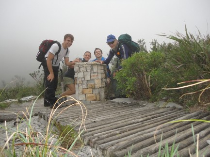 Above - Left to Right: Tarren, Kate, Peter & Ruedi Below - The hike wrapped around the front of Table Mountain .jpg.opt434x287o0,0s434x287.jpg) |
===========================================================================================================================================================
Training Hike 2: Table Mountain - Sunday, 6 June 2010(by Peter Wynne) On an absolutely freezing cold Sunday morning 4 Volunteer Wildfire Services members showed up at Newlands base to participate in the 2nd Endurance Challenge training hike. Having gathered, everyone wondered why they were actually there and when complete insanity had set in. The mountain was completely covered in cloud but that was our ultimate goal. After packing more than enough warm clothes, food and navigation equipment (which included the human-powered GPS we fondly call Ruedi) a long discussion ensued about the route given the freezing and rainy conditions. Given that we were already getting steadily wetter from the rain we decided climbing up the water fall coming down Skeleton gorge couldn’t make us that much wetter. From there we trudged along the path to Maclear’s Beacon and on to the top of Platteklip Gorge. The path seemed to go on forever in the cold mist and occasional gentle drizzle, but with the help of our human GPS we safely made it to Platties. Having descended a little way we had our first, much needed stop, out of the wind and mist. The original aim was to head back to Newlands via the top of Devil’s Peak but having quickly walked the upper contour trail (with an odd patch of some warmth trying to make its presence felt) to the saddle and ascended the saddle, we realise it just wasn’t safe to attempt the climb the worsen conditions. Thus, we trekked down Newlands Ravine, along the contour path and woodcutters trail back to base… just in time to all head off for much needed lunch and some warmth. Lesson learnt: Hiking in freezing cold cloudy conditions on the
top of Table Mountain early Sunday morning might possibly be a little less fun
than staying in bed… (although I think there might be a few mad people who
could disagree with me – I hope I’m not becoming one of them…) Stats: Distance covered: 16.6km Time: 5 hrs 16 mins Altitiude gained: 1410 metres | .jpg.opt429x284o0,0s429x284.jpg) Above - The hiked route took us from Newlands Fire Base, up over Table Mountain and back again Below - Ezan, Kate and Peter take shelter from the rain along the upper contour trail  - Picture.jpg.opt427x320o0,0s427x320.jpg) |
===========================================================================================================================================================
Training Hike 1: Table Mountain - Sunday, 29 May 2010(by Ryan Heydenrych) It was a clear winter morning when Peter,
Yuri and I (Ryan) set out for a challenging hike. After posing for a quick
photo at base we set off just after 08h00. From the beginning we set the pace quite high as we had a fair distance that we wanted to cover. We began at VWS Newlands and hiked up until we reach the contour path. It’s a strange contour path as it has quite a step climb and then decent before you reach Skeleton Gorge but we pushed on passing a few walkers along the way. The hike up Skeleton Gorge was fresh but the promise of the warm sun on the top was great motivation. Once at the top of Skeleton we proceeded to the dam, crossing along the dam wall and headed along the old railway towards Kasteelsport. On route down Kasteelsport we paused to take in the scenery of Lions Head, Camps Bay and the Atlantic Ocean that extends to the horizon. It was a day that made you appreciate these mountains that we have on our doorstep. On the way down Corridor we hit the pipe track. We turned left and headed in the direction along a more gentle path towards Corridor. The path up Corridor was missed, although clearly visible, so we did an extra 15 minutes we hadn’t planned on doing. A reason for doing these hikes is to gain knowledge about routes we will follow and perhaps areas where future fire fighting operations may take place. This was a great example of learning where the paths lead. It was at this stage of the hike that Peter and I both silently wondered if Yuri was carrying his full fire fighting kit. He had his pack but the question was, was it full? The accent is very steep so carrying a full pack up there is no easy task. We all did pretty well and in fact felt so good about the hike so far we decided to add on a few extra kilometres. We headed back to the dams but instead of taking the direct way back to base we went down towards Constantia Nek. Peter distracted us from our fatigued legs by telling us about a fire that he had attended on the slope we were walking down. Thanks Peter. Passing through the top of Kirstenbosch we
then made our way back to base. It was a great introductory hike. Stats: Distance covered: 26.7 km Time: 6 hrs 09 mins Altitude gained: 1800 metres |  Above - Left to Right: Yuri, Ryan & Peter at VWS Newlands Base Below - The hike up and over Table Mountain (twice).jpg) |